


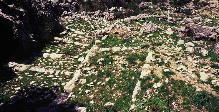
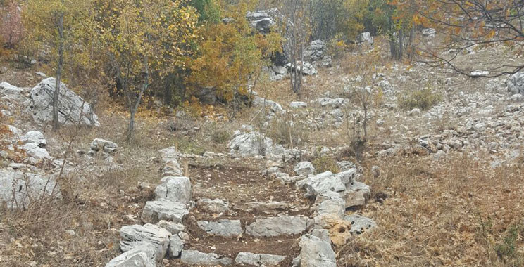
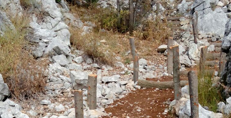
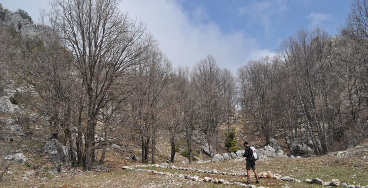
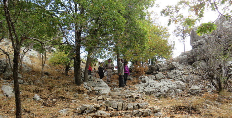
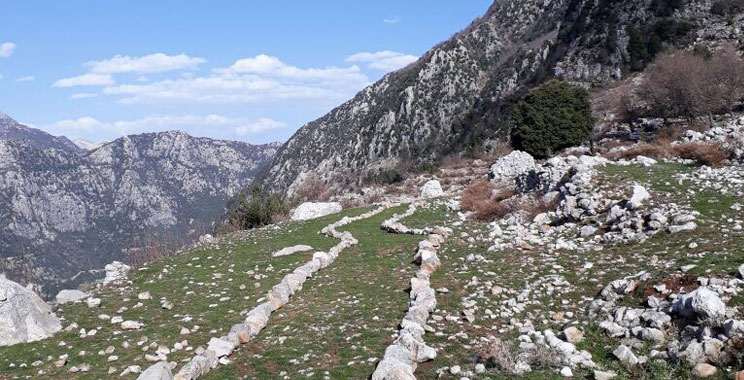
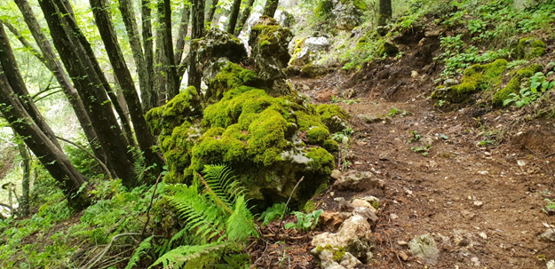
The Roman stairs
Trail 4: The Roman Stairs
Level: Easy
Distance: 2.3km
Duration: 1h hike
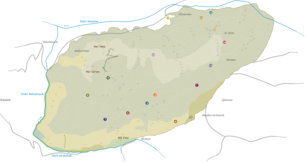
Start point: Qehmez entrance
End point: Mchati entrance
Entry fees: 4 USD above 16 yrs, 2 USD under 16 yrs
Guiding fees (optional): 25 USD + (15 USD transportation)
Itinerary:
- Start at Qehmez main entrance (1400m).
- Easy downhill hike from Qehmez entrance - Roman Stairs trail- reaching the Mchati reserve entrance.
- Arrival to the Mchati hamlet- Roman Stairs Trail (1050m).
Description:
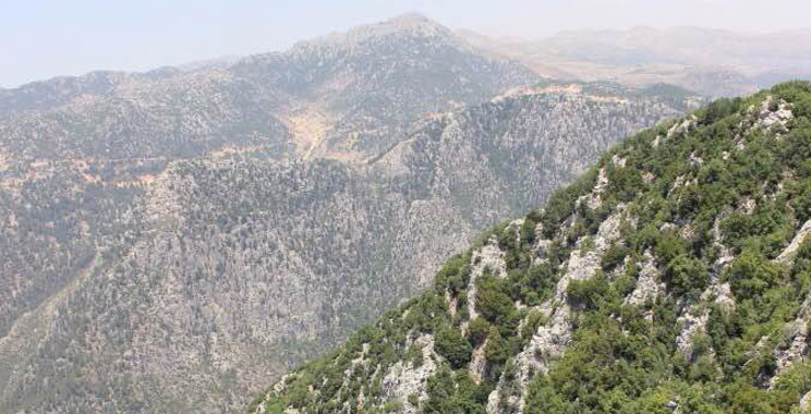
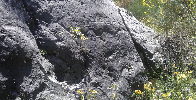
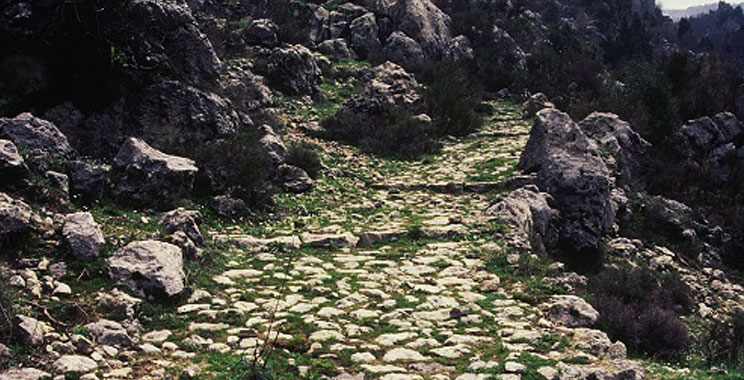
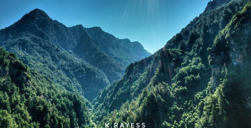
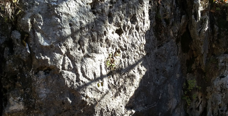
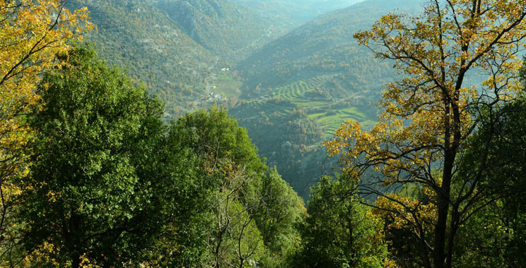
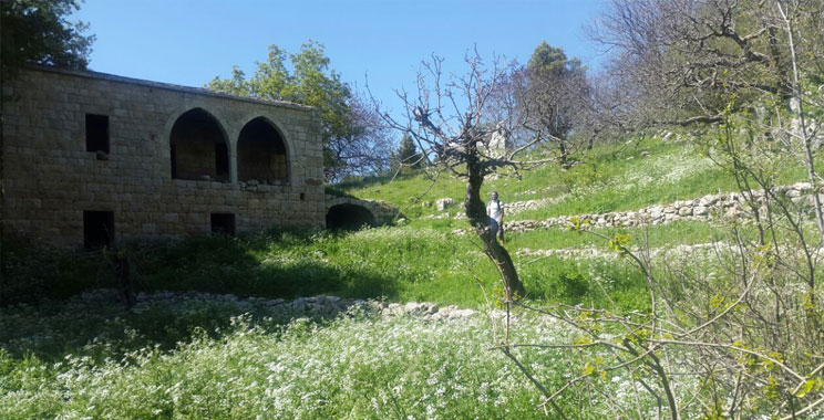
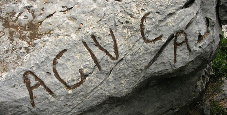
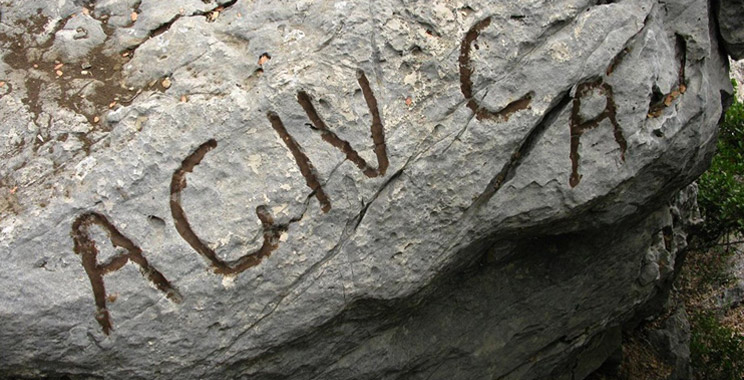
Integrated in the reserve as a peripheral circuit connecting the two main entrances of Mchati and Qehmez through an attractive landscape, this trail, better known as the Roman Stairs, is part of the local and regional heritage of Jabal Moussa. The stairs that climb up Jabal Moussa represent the best preserved part in Lebanon. Along the way a large Latin inscription of Emperor Hadrian is engraved on an upright rock, clearly visible, contributing to the “Roman flavor” of this trail.
Chouwan Cultural Trail
RESERVATION IS MANDATORY FOR CHOUWAN; only a limited number of visitors can be accepted because of the COVID-19 spread.
Trail 11: Chouwan Cultural Trail
Level: Easy
Distance: 1.4km
Duration: 50min hike
Start point: Chouwan entrance
End point: Chouwan entrance
Entry fees: 4 USD above 16 yrs, 2 USD under 16 yrs
Guiding fees (optional): 25 USD + (15 USD transportation)
Itinerary:
- Start at the Chouwan entrance where an APJM boutique and its facilities are available for all hikers.
- Easy walk downhill along a trail that crosses over Chouwan river, then over Adonis river through an ancient stone bridge, and reaches the Ottoman site of Chouwan.
- Back on the same trail to Chouwan entrance.
Description:
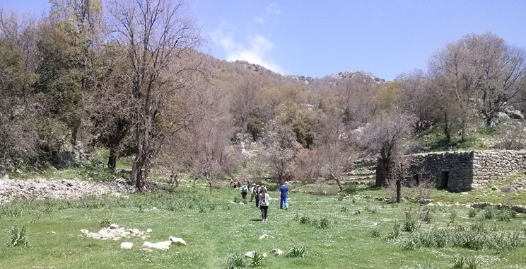
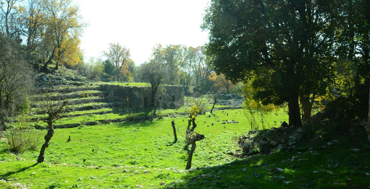
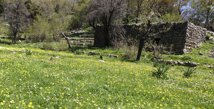
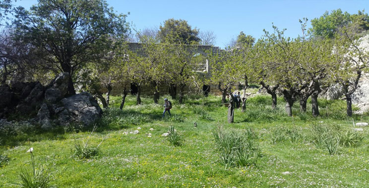
This trail is a true remote hike into wilderness, and yet is peppered with several cultural landmarks including two abandoned farms of the Ottoman Period surrounded by agricultural terraces. Next to the first abandoned farm is an olive press. Further down towards the lake, one can observe two water mills where the ancestral mechanisms of wheat grinding are still visible. A partly reconstructed stone bridge, linking between the cazas of Jbeil and Kesserwan, will allow the visitors to cross the historic Adonis River (Nahr Ibrahim). This trail offers an overview of the economic infrastructure and typology of the Lebanese farmers in the 19th century.
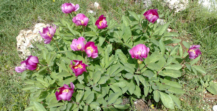
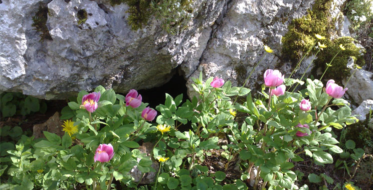
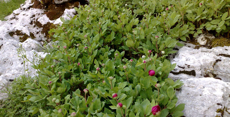
Peony Trail
Trail 1: Peony trail
Level: Easy+
Distance: 2.1km
Duration: 1h30min hike
Start point: Qehmez entrance
End point: Qehmez entrance
Entry fees: 4 USD above 16 yrs, 2 USD under 16 yrs
Guiding fees(optional): 25 USD + (15 USD transportation)
Itinerary:
- Start at Qehmez main entrance (1400m).
- Easy to moderate uphill hike from Qehmez entrance reaching the "PaeoniaKesrouanensis" panel.
- Take the new Peony trail passing by an abandoned Quarry until reaching the road.
- Back to Qehmez main entrance (1400m).
Description:
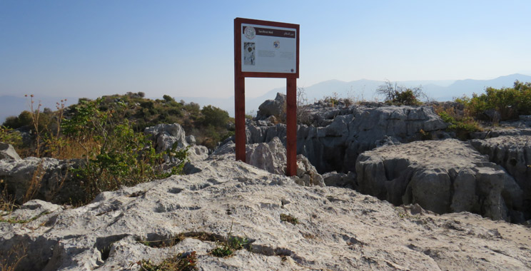
This walk represents a true mix of nature and culture. Worth mentioning is the “Sinkhole” that is a depression carved in a karstic area, the Emperor Hadrian's Inscriptions, as well as the Peony site that hosts an endemic peony species “Paeoniakesrouanensis”.

Qornet el Deir Loop
Trail 5: Qornet el Deir Loop
Level: Easy+
Distance: 2.0km
Duration: 1h30min hike
Start point: Qehmez entrance
End point: Qehmez entrance
Entry fees: 4 USD above 16 yrs, 2 USD under 16 yrs
Guiding fees(optional): 25 USD + (15 USD transportation)
Itinerary:
- Start at Qehmez main entrance (1400m).
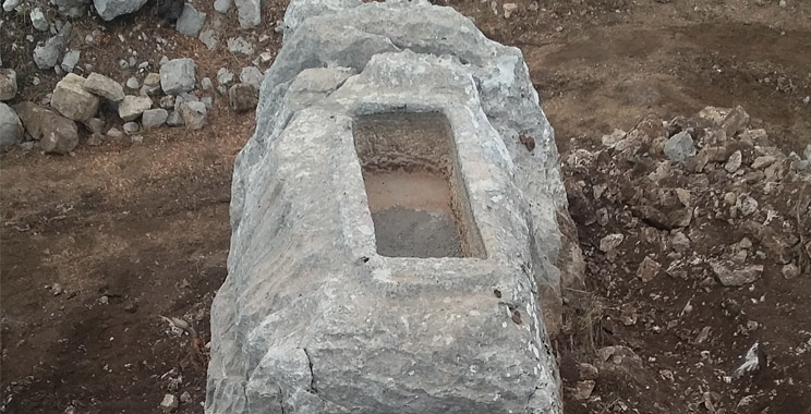
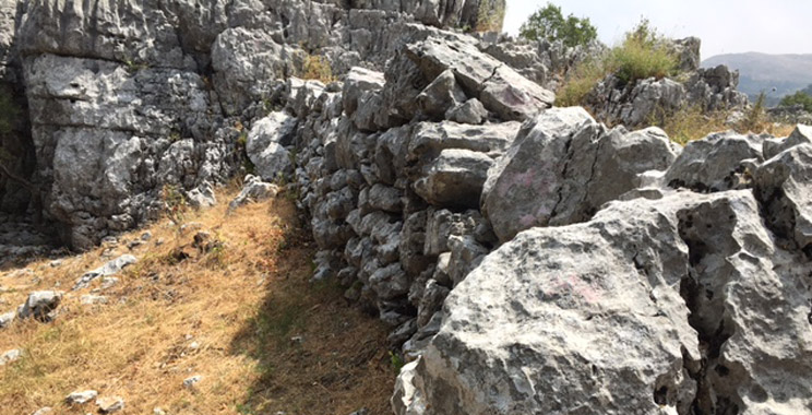
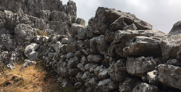
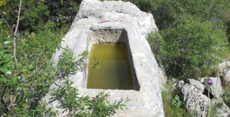
- Easy downhill hike from Qehmez entrance reaching the cultural site of Qornet el Deir passing by several cultural monuments (Roman wall, Lime Kiln, Roman Well/Basin).
- Moderate uphill hike towards the newly discovered inscription of the Roman Emperor Hadrian known to have been one of the first to engage in Forest management.
- Back to the start point: Qehmez main entrance.
Description:
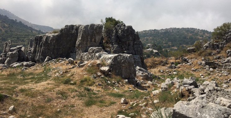
The Qornet el Deir site is on the top of a hill, overlooking the roman road and it presents itself as an almost circular flat space within a natural compound enclosed on all sides by rocks some over 4 to 5m high protecting it from any outside incursion.
Trail of the violets
Trail 15: Trail of the Violets
Level: Easy+
Distance: 2.1km
Duration: 1h30min hike
Start point: Near Qehmez entrance
End point: Broqta side entrance
Entry fees: 4 USD above 16 yrs, 2 USD under 16 yrs
Guiding fees (optional): 25 USD + (15 USD transportation)
Itinerary:
- Start near Qehmez entrance (altitude: 1,350m)
- Moderate uphill hike
- Easy downhill walk
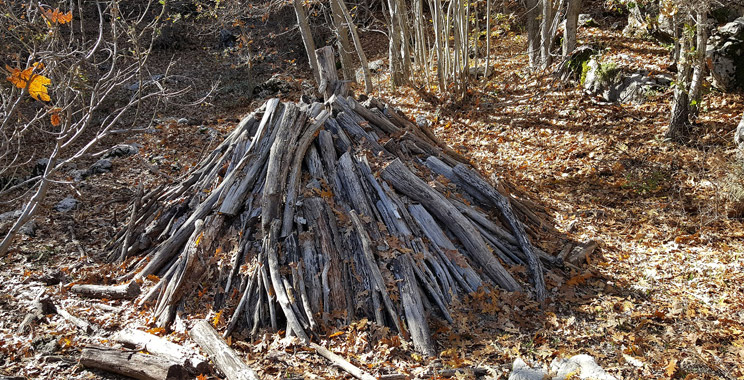
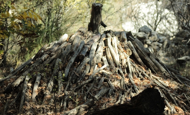
- Optional: Instead of ending the hike in Broqta side entrance, you can walk down on the Adonis Gorge trail to reach Al Iibri village. Severe downhill walk passing by charcoaling spots. But in this case you will need a car to pick you up back to Qehmez entrance.
- Arrival to Broqta side entrance (altitude: 1,240m)
Description:
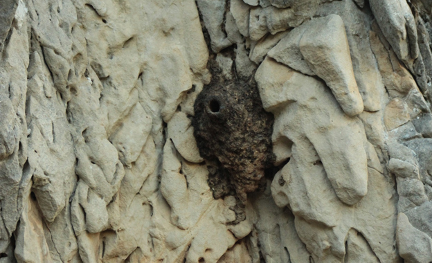
An easy trail with moderate uphill and downhill, suitable for most hikers. The trail meanders through one of the most diverse spots of Jabal Moussa, where a dense, humid forest shelters endemic flowers and very beautiful specimens of rare tree species, such as the largest Quercus cerris of the reserve, the endemic wild apple, Malus trilobata. A beautiful nest of Western rock nuthatch is encountered along the trail. The cultural aspect of the trail is also very rich, represented by two Roman rock inscriptions, a charcoaling spot and noticeable impact of ancestral pruning activities on “multi-stem” trees.
Qornet el Mzar Trail
Trail 2: Qornet el Mzar Trail
Level: Moderate
Distance: 3.3km
Duration: 2h15min hike
Start point: Qehmez entrance
End point: To be combined with another trail to reach an entrance
Entry fees: 4 USD above 16 yrs, 2 USD under 16 yrs
Guiding fees (optional): 30 USD + (15 USD transportation)
Itinerary:
- Start your hike at Qehmez main entrance (1400m).
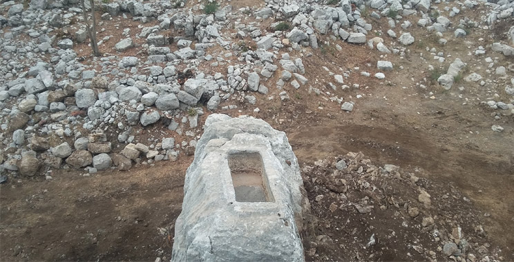
- Moderate uphill hike reaching Bir el Masbek, an old water cistern found carved in the karstic rocks.
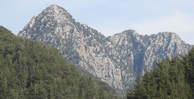
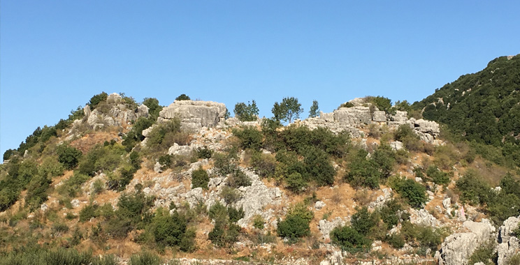
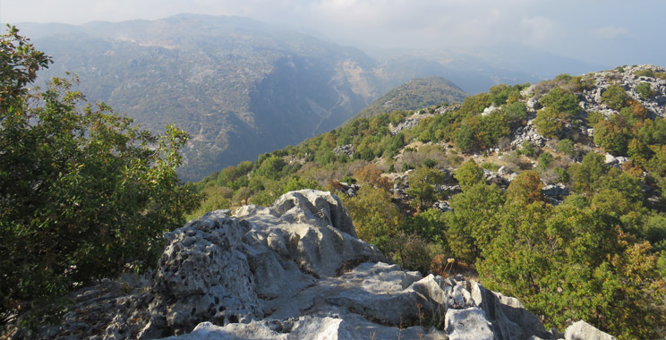
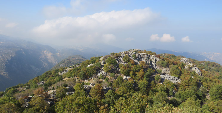
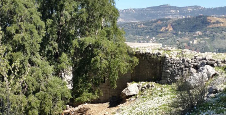
- Uphill detour from Bir el Masbek towards Qornet el Mzar (1600m), the highest summit of Jabal Moussa that shelters ruins of a Roman temple and amazing 360⁰ view on the diverse landscapes surrounding Jabal Moussa; a true mix of nature and culture.
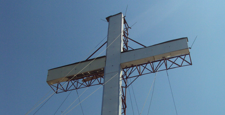
- Easy downhill hike towards the Cross of Yahchouch that was erected by Yahchouch youths on the summit of Jabal Moussa, overlooking the historical Adonis Valley.
- Take the same trail back to Qehmez main entrance, or combine it with another trail to reach Mchati entrance or Yahchouch side entrance.
Description:
This walk represents a true journey in time. You'll learn how our grandfathers managed to survive on isolated land and discover the marks our ancestors left on the mountain's steep slopes... A walk through open and dense mixed forest, where karstic landscapes of the mountain summit can be admired.
The highlight of the walk is “Qornet el Mzar”, the highest summit of Jabal Moussa (1600 m) that shelters ruins of a Roman temple and amazing 360⁰ view on the diverse landscapes surrounding Jabal Moussa.
El-Byut Stroll
Trail 3: El-Byut stroll
Level: Moderate
Distance: 3.5km average
Duration: 2h15min hike
Start point: Qehmez entrance
End point: To be combined with another trail to reach an entrance
Entry fees: 4 USD above 16 yrs, 2 USD under 16 yrs
Guiding fees (optional): 30 USD + (15 USD transportation)
Itinerary:
- Start at Qehmez main entrance (1400 m).
- Moderate hike along the “El-Byut stroll”: from Qehmez entrance passing by Bir el Masbek and arriving to three old houses known as El Byut (Old houses site- 1350m).
- Optional: After the Byut, walk up to the Cross of Yahchouch where the historical Adonis Valley can be admired, then back to the Byut site on the same track. An additional 30 min should be foreseen for this detour.
- Take the same trail back to Qehmez main entrance, or combine it with another trail to reach Mchati entrance or Yahchouch side entrance.
Description:
This walk represents a true journey in time; learn how our grandfathers managed to survive on isolated land, and discover the marks our ancestors left on the mountain’s steep slopes. Walk through open and dense mixed forests, admire the karstic landscapes of the mountain summit and stroll around easily in the open spaces the trail offers!
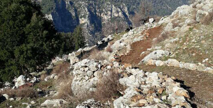
Shepherds encounter trail
Trail 8: Shepherds encounter trail
Level: Moderate
Distance: 2.5km
Duration: 2h hike
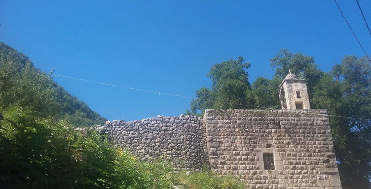
Start point: Yahchouch side entrance (Mar Geryes)
End point: Nahr ed Dahab side entrance
Entry fees: 4 USD above 16 yrs, 2 USD under 16 yrs
Guiding fees (optional): 30 USD + (15 USD transportation)
Itinerary:
- Start at Mar Geryes- Yahchouch side entrance.
- Easy stroll East along a trail that goes around Jabal Moussa (with mild ups and downs) and reaches Nahr ed Dahab (Golden River).
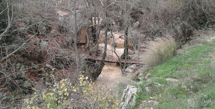
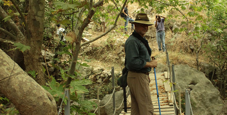
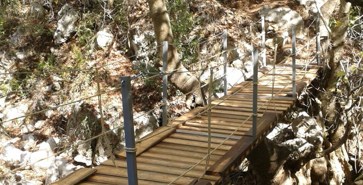
- Cross Nahr ed Dahab over a wooden bridge.
- Arrival to Nahr ed Dahab side entrance.
Description:
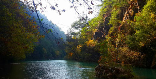
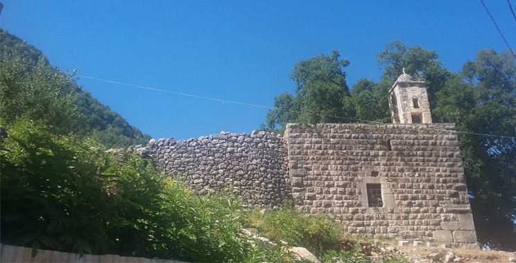
An easy trail that starts at Mar Geryes monastery, an abandoned convent built on Roman remains, and turns round Jabal Moussa, overlooking the “Golden River” (Nahr ed Dahab). In autumn, the tall sycamore trees surrounding the river lose their golden yellow leaves, coloring the river in gold. While hiking, you will discover the origin of the trail name, the Shepherd’s encounter and you will get the chance to bravely cross the river.
El-Jalseh Trail
Trail 10: El-Jalseh Trail
Level: Moderate
Distance: 4.8km
Duration: 2h30min hike
Start point: Yahchouch side entrance (Mar Geryes)
End point: Al Iibre side entrance
Entry fees: 4 USD above 16 yrs, 2 USD under 16 yrs
Guiding fees (optional): 30 USD + (15 USD transportation)
Itinerary:
- Start at Yahchouch side entrance (Mar Geryes Convent).
- Moderate uphill hike passing by carob trees, hop-hornbeams, oregano and three-lobed apple.
- Arrival to Al Iibre side entrance end point.
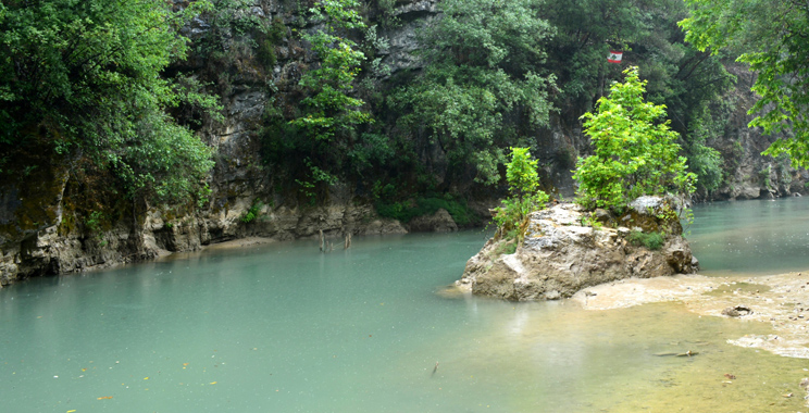
Lake Trail
Trail 12: Lake Trail
Level: Moderate
Distance: 1.8km
Duration: 50min hike
Start point: Chouwan entrance
End point: Chouwan entrance
Entry fees: 4 USD above 16 yrs, 2 USD under 16 yrs
Guiding fees (optional): 30 USD + (15 USD transportation)
Itinerary:
- Start at Chouwan entrance.
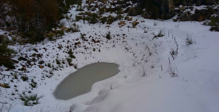
- Easy hike reaching Chouwan lake.
- Return along the same trail (moderate to difficult), 1.8km / 50min hike will be added.
- Back to Chouwan entrance.
Description:
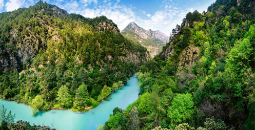
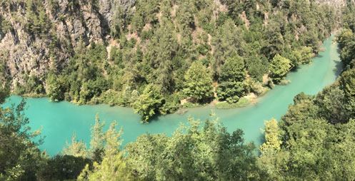
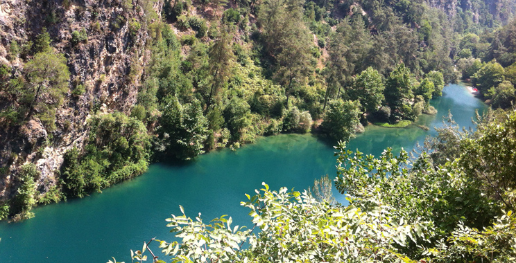
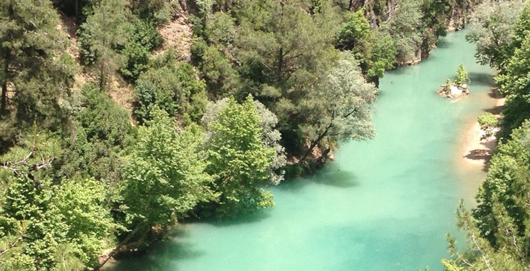
Discover Jabal Moussa in green and blue with this chill trail! You will start your walk under the shade of the tall pine trees, then meander through the uphill and downhill slopes, uncovering beautiful spots for shooting pictures. The trail leads you to the charming Chouwan lake at the depths of the historical Adonis Valley. The way back is not easy, for the easy downhill slopes on your way down become uphill on your way back!
Hadrian’s incline trail
Trail 6: Hadrian’s incline trail
Level: Difficult
Distance: 1.6km
Duration: 2h hike
Start point: Mchati entrance (Mar Elias)
End point: Mchati entrance (Mar Elias)
Entry fees: 4 USD above 16 yrs, 2 USD under 16 yrs
Guiding fees (optional): 45 USD + (15 USD transportation)
Itinerary:
- Start at Mchati main entrance, next to Mar Elias church (1050 m).
- Advanced hike (uphill) from Mchati along the Hadrian’s incline passing by the Emperor Hadrian Inscriptions and reaching the Byut site (1350 m).
- Optional: After the Byut, walk up to the Cross of Yahchouch where the historical Adonis Valley can be admired, then back to the Byut site on the same track. An additional 30 min should be foreseen for this detour.
- Walk back to the starting point: Mchati (next to St Elias church) (1050 m).
Description:
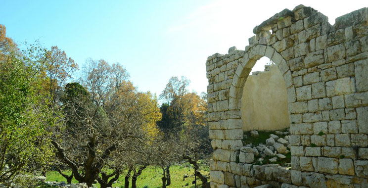
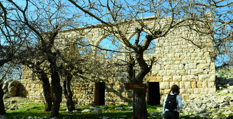
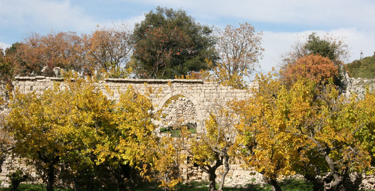
The steep slope on Mar Elias church let you climb up away from civilization and gradually enter the wild forest of Jabal Moussa, where you observe Roman inscriptions amid the mixed evergreen and deciduous forest. These inscriptions are better known as “Hadrian’s inscriptions” as they were ordered by Hadrian, a Roman Emperor from 117 A.C known to have been one of the first to engage in Forest management. The byut site is not to be missed, where an abandoned small village stands still, relic of our forefather’s traditional lifestyle and vernacular architecture.
Cerris Trail
Trail 7: Cerris Trail
Level: Difficult
Distance: 3.3km
Duration: 2h15min hike
Start point: Nahr ed Dahab entrance
End point: At a distance of 450 meters from the Byut square (to be combined with another trail to reach an entrance)
Entry fees: 4 USD above 16 yrs, 2 USD under 16 yrs
Guiding fees (optional): 45 USD + (15 USD transportation)
Itinerary:
- At a distance of 450 meters from the Byut square (to be combined with another trail to reach an entrance)
- Cross the river over a wooden bridge
- Difficult uphill hike along the Cerris trail
- Arrival to crossroads (altitude: 1,300 m), at a distance of 450 meters from the Byut square and 1,070 meters from Mchati entrance
- Take the same trail back to Nahr ed-Dahab entrance, or combine it with another trail to reach Mchati or Qehmez entrances
Description:
A challenging uphill trail, inside a diverse dense forest, of evergreen oak combined with broadleaf species. The trail crosses the “Golden River” (Nahr ed-Dahab), and passes through tall sycamore trees, that lose their golden yellow leaves during autumn. An uphill hike offers scenic views on the valley, then leads to a dense and humid forest with endemic flowers and a diverse mix of tree species, including tall specimens of Quercus cerris or Juniperus drupacea.
Charme houblon trail
Trail 9: Charme houblon trail
Level: Difficult
Distance: 1.8km
Duration: 50min hike
Start point: Yahchouch side entrance (Mar Geryes)
End point: To be combined with another trail to reach an entrance
Entry fees: 4 USD above 16 yrs, 2 USD under 16 yrs
Guiding fees (optional): 45 USD + (15 USD transportation)
Itinerary:
- Start at Yahchouch side entrance, Mar Geryes.
- Difficult uphill hike to Yahchouch Cross site along the Charme Houblon.
- Easy stroll after the cross arriving to three old houses known as El Byut (Byut/ Old houses site- 1350m).
- Take the same trail back to Yahchouch side entrance, or combine it with another trail to reach Mchati entrance, Nahr Ed Dahab entrance or Qehmez main entrance
Description:
Start your hike with history: at the beginning of the Charme Houblon trail lies “Mar Geryes monastery”, an abandoned convent built on Roman remains. Then defy the mountain’s steepness and climb along the Northern side of the mountain, humid and green. You won’t get any rest before you reach the Cross site at the mountain summit: once there, you’ll get rewarded by a remarkable panoramic view on the villages below you and the amazing Adonis Valley. Then continue your journey by learning how our grandfathers managed to survive on isolated land at the Byut site.
Arbutus Trail
Trail 13: Arbutus Trail
Level: Difficult
Distance: 2.8km
Duration: 2h hike
Start point: Chouwan entrance
End point: At a distance of 400 meters above Chouwan Lake
Entry fees: 4 USD above 16 yrs, 2 USD under 16 yrs
Guiding fees (optional): 45 USD + (15 USD transportation)
Itinerary:
- Start at Chouwan entrance.
- Advanced hike (uphill) from Chouwan along the Atlab trail.
- Turn before reaching Al iibré village.
- Moderate downhill walk toward the Lake trail.
- Optional: Visit of Chouwan Lake (an additional 30 minutes should be foreseen for this detour).
- Moderate to difficult return along the lake trail, an additional 1.8km/50 min hike will be added
- Back to Chouwan entrance.
Description:
A perfect trail for any passionate about nature and adventure. This trail meanders through the bushy humid forest of Chouwan, overlooking the majestic canyon of Adonis river (Nahr Ibrahim), passing through the laurel-scented forest of Al iibré, crossing the Chouwen water source right before reaching the lake (optional), and then coming back to the start point through a different path. It features quality scenic views, a wild setting, a dramatic canyon view, as well as rich biodiversity and flora endemism.
Adonis Gorge trail
Trail 14: Adonis Gorge trail
Level:Difficult
Distance: 2.1km
Duration: 1h30min hike
Start point: Broqta side entrance
End point: Al Iibre side entrance
Entry fees: 4 USD above 16 yrs, 2 USD under 16 yrs
Guiding fees (optional): 45 USD + (15 USD transportation)
Itinerary:
- Start at Broqta side entrance (1240 m).
- Moderate uphill hike passing by Quercus Cerris trees, Three-lobed apple trees.
- Severe downhill walk passing by charcoaling spots.
- Arrival to Al Iibre side entrance end point (900m).
Description:
This old way was used by the local population as a shortcut from the village of Qehmez to Al Iibre and back and it helped develop strong social and economic relations between the two villages. Start your hike from the agricultural plains of Broqta, Hike between diverse tree species, discover how the locals used to charcoal and witness a panoramic view of the majestic Adonis Valley and the Caza of Jbeil.